How I Help in my Spare Time - or - Virtually for instance to the Democratic Republic of the Congo

30. 06. 2017
3 minuty čtení
I recently got involved in a volunteer project called Missing Maps, founded in 2014 by the American Red Cross, the British Red Cross, Doctors Without Borders and the OpenStreetMap humanitarian team. This year in the Czech Republic, Missing Maps celebrated its first anniversary. Under this project, employees from the organizations that founded the initiative, along with volunteers, are helping to draw up maps of areas where no maps exist. This mostly involves extremely remote areas or hard to reach places.
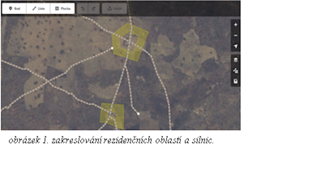
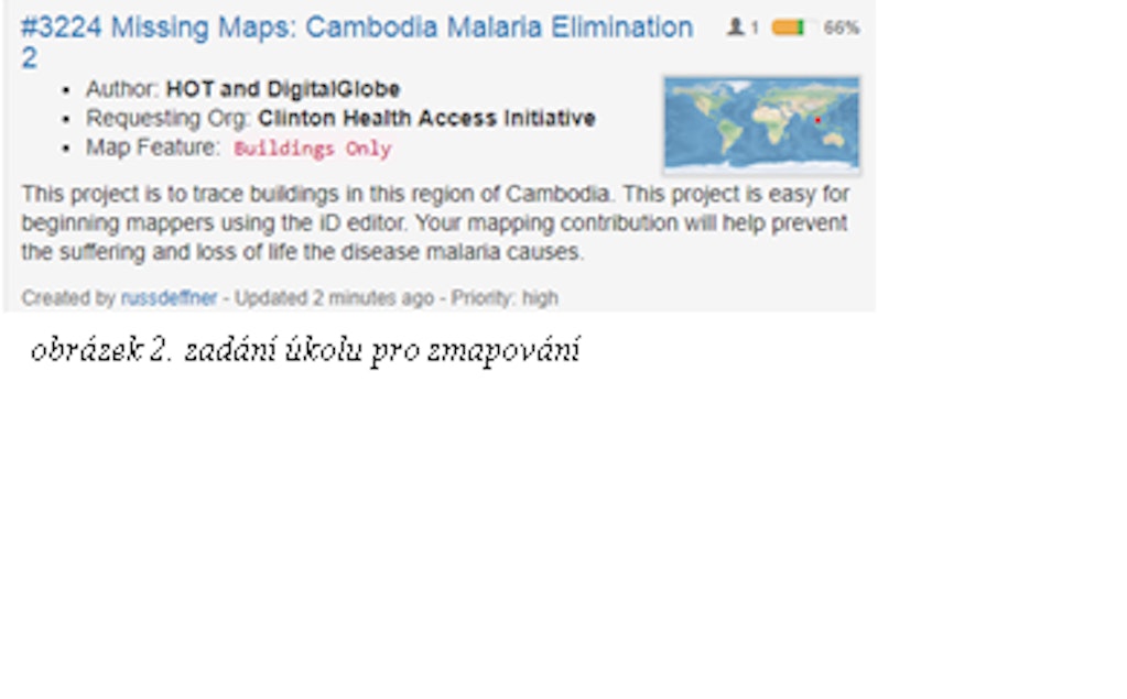
These mapped areas help organizations localize populations, either for medical assistance (vaccinations against diseases such as the Ebola virus or malaria) or for development assistance. The mapping works as follows: by means of OpenStreetMap, you draw residential areas and roads into satellite images, thus creating a map in various editors. That sounds a bit complicated, but you really don’t have to be an IT guru or geographer. In lay terms, I would explain that you simply draw a road right into an image, the likes of which you know e.g. from Google maps. It always depends on the assignment by a given organization and their needs or requirements. Sometimes for example, it is only necessary to draw in individual buildings, and other times just villages and the roads joining them. The assignment always stems from the purpose for which the map is to be formed. Tasks are also classified based on urgency. The organization always specifies in the given area just how urgent creating the map is. Here in the second picture, you can see an example where it is truly urgent – “priority: high”. In the project, we may encounter such cases as the outbreak of Ebola in the Democratic Republic of the Congo or the spread of malaria in Cambodia, Mali or Zambia.
Image 1 – Drawn-in residential areas and roads
Image 2 – Assigning a mapping task
You are certainly not alone when it comes to helping. Once per month, there is a ‘Mapathon’, or meeting of volunteers who want to map together or want to learn. It takes place in the last week in the month and includes training on the entire program (how to map in various editors, but also how to validate finished parts). Nevertheless, it is even possible to map from home. Actually whenever you have spare time, you can help form a map for a particular section, thus assisting humanitarian organizations. So for example, you peer into a small village in the Democratic Republic of the Congo to which Ebola has just spread. You map all the dwellings in it and the access roads, and in doing so, you can even save lives - remotely. If you would like to take part, just go to Missing Maps’ Facebook page for the Czech Republic and Slovakia. In this group, among other things, the date (last week in the month) and the place of the Mapathons are always posted. So if I am not in school, on a walk with my dogs or at work, rest assured that I am going through some village....via the Internet. And who knows, maybe I will be able to help one day even as a member of a non-profit organization.


Who do we help
The Kellner Family Foundation
2026 © THE KELLNER FAMILY FOUNDATION